Harry Beck: The Engineer Who Drew London Wrong
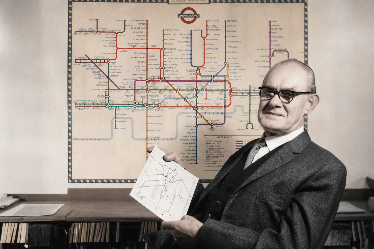
By the early 1930s, London’s Underground had become increasingly difficult to understand.
Every extension added new stations, new interchanges and new routes. Travelling somewhere unfamiliar often meant stopping to study a map, tracing lines with a finger, counting stations and hoping you hadn’t missed a crucial change before you could even begin your journey.
One engineering draftsman in London Transport’s Signals Office thought the problem wasn’t the railway. It was the map. His name was Harry Beck.
Beck had never designed a map before. Nor had anyone asked him to look at this one. He was employed to draw electrical signalling diagrams. But the problem captured his imagination. In his spare time, working unpaid at his kitchen table, he began sketching an idea that would occupy him for much of the rest of his life.
Beck was not trained to think like a cartographer. He thought like an engineer.
Unlike a conventional map, whose purpose is to provide a geographically accurate representation of the landscape, Beck’s map was designed to answer just one question: how do I get where I want to go?
Exact distances, winding tracks and the precise position of each station were irrelevant. What mattered was helping passengers choose the right line, travel in the right direction, know where to change trains and when to get off.
Everything else could be stripped away.
Beck produced a map unlike any seen before. Underground lines ran only horizontally, vertically or at forty-five degrees. Stations were evenly spaced. The tangled railway beneath London became a simple visual diagram that favoured clarity over geography.
London Transport was unconvinced. The design looked too unlike a conventional map and was initially rejected. Eventually, the organisation agreed to print a trial run of just 500 copies. Londoners loved it.
The maps disappeared almost as soon as they were made available. Beck’s design was quickly adopted across the Underground and, over time, became one of the most recognisable maps in the world. Metro systems around the world would later adopt the same principles.
For Beck, however, the work never really ended. The map became a lifelong obsession. He continued refining it for decades, often disagreeing with London Transport over changes and revisions, convinced it could always be made clearer.
Millions of people now navigate cities using Beck’s idea without ever knowing his name.
Nearly a century later, transport maps across the world still follow the principles he first sketched, unpaid, at his kitchen table.
Further reading
Mr Beck’s Underground Map by Ken Garland